Whether you drive an electric car, a ‘normal’ car, or don’t drive at all, this web and mobile (Android and iOS) application from ZapMap is well worth taking a look at. Powered by Google Maps API, this mapping tool provides the locations of electric car chargers, providing pop up boxes with the latest status of these charging points, types and directions on how to get there. Although the shading of the vector tiles is a bit gaudy, with an ability to log in, map and comment on charging points, there is potential for up-to-date community empowered mapping to provide latest running statuses and charging locations.
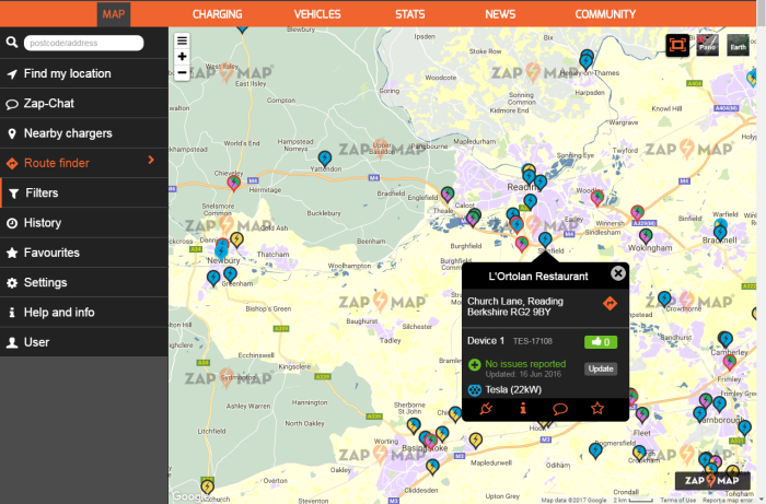
A simple but intuitive interface does the trick as well, though it isn’t obvious what the symbology of the points mean without an obvious legend. While this isn’t going to make everyone opt for ‘greener’ transport solutions (and there is debate as to how ‘green’ electric cars actually are), it was an eyeopener to myself how many charging points are now available for electric cars, at least in urban areas.Often seen as a barrier to the adoption of electric cars, this does appear to be less of an excuse now, at least from the density of apparent charging points. The website itself provides extra information on statistics on electric cars, as well as guides and tips for the market. Although, only for UK users, it may expand further geographically, and there may already be similar apps and maps in your region, if not, a only a matter of time, or something to create yourself!
Happy Mapping,
David
Credits: ZapMap, Google Maps
